


UNION 1 Voting District, Union County, Illinois
About
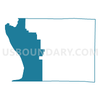
Outline

Summary
| Unique Area Identifier | 574969 |
| Name | UNION 1 Voting District |
| County | Union County |
| State | Illinois |
| Area (square miles) | 114.27 |
| Land Area (square miles) | 107.62 |
| Water Area (square miles) | 6.65 |
| % of Land Area | 94.18 |
| % of Water Area | 5.82 |
| Latitude of the Internal Point | 37.46818660 |
| Longtitude of the Internal Point | -89.40975320 |
Maps


Graphs
Select a template below for downloading or customizing gragh for UNION 1 Voting District, Union County, Illinois


Neighbors
Neighoring Voting District (by Name) Neighboring Voting District on the Map
- Altenburg Voting District, Perry County, MO
- ALTO PASS Voting District, Union County, IL
- GRAND TOWER Voting District, Jackson County, IL
- JONESBORO 2 Voting District, Union County, IL
- JONESBORO 3 Voting District, Union County, IL
- MC CLURE Voting District, Alexander County, IL
- MILL CREEK Voting District, Union County, IL
- Neelys Landing/Oriole Voting District, Cape Girardeau County, MO
- Nell Holcomb Voting District, Cape Girardeau County, MO
- New Wells Voting District, Cape Girardeau County, MO
- POMONA Voting District, Jackson County, IL
- TAMMS Voting District, Alexander County, IL
Top 10 Neighboring County Subdivision (by Population) Neighboring County Subdivision on the Map
- Cape Girardeau township, Cape Girardeau County, MO (40,563)
- Randol township, Cape Girardeau County, MO (4,431)
- Shawnee township, Cape Girardeau County, MO (3,910)
- Tamms precinct, Alexander County, IL (1,696)
- Jonesboro District 2 precinct, Union County, IL (1,126)
- Brazeau township, Perry County, MO (1,100)
- McClure precinct, Alexander County, IL (1,034)
- Union precinct, Union County, IL (983)
- Alto Pass precinct, Union County, IL (834)
- Pomona township, Jackson County, IL (802)
Top 10 Neighboring Place (by Population) Neighboring Place on the Map
Top 10 Neighboring Elementary School District (by Population) Neighboring Elementary School District on the Map
- Jonesboro Community Consolidated School District 43, IL (2,991)
- Nell Holcomb R-IV School District, MO (2,812)
- Altenburg 48 School District, MO (1,046)
Top 10 Neighboring Secondary School District (by Population) Neighboring Secondary School District on the Map
Top 10 Neighboring Unified School District (by Population) Neighboring Unified School District on the Map
- Jackson R-II School District, MO (30,067)
- Murphysboro Community Unit School District 186, IL (15,612)
- Cobden School Unit District 17, IL (3,538)
- Shawnee Community Unit School District 84, IL (2,818)
Top 10 Neighboring State Legislative District Lower Chamber (by Population) Neighboring State Legislative District Lower Chamber on the Map
- State House District 115, IL (105,561)
- State House District 118, IL (99,068)
- State House District 157, MO (37,900)
Top 10 Neighboring State Legislative District Upper Chamber (by Population) Neighboring State Legislative District Upper Chamber on the Map
- State Senate District 58, IL (216,350)
- State Senate District 59, IL (209,843)
- State Senate District 27, MO (172,783)
Top 10 Neighboring 111th Congressional District (by Population) Neighboring 111th Congressional District on the Map
Top 10 Neighboring Census Tract (by Population) Neighboring Census Tract on the Map
- Census Tract 8806, Cape Girardeau County, MO (6,347)
- Census Tract 8801, Cape Girardeau County, MO (5,738)
- Census Tract 4705, Perry County, MO (3,829)
- Census Tract 9505, Union County, IL (3,770)
- Census Tract 103, Jackson County, IL (3,115)
- Census Tract 9576, Alexander County, IL (2,928)
- Census Tract 9502, Union County, IL (2,592)
Top 10 Neighboring 5-Digit ZIP Code Tabulation Area (by Population) Neighboring 5-Digit ZIP Code Tabulation Area on the Map
- 63701, MO (36,812)
- 63755, MO (24,006)
- 62952, IL (3,372)
- 62957, IL (996)
- 63732, MO (834)
- 62942, IL (707)
- 62905, IL (677)
- 62998, IL (419)